Lahontan GeoScience provides seismic hazard assessment services with expertise in the following areas:
- Seismotectonic evaluations
- Geological fault evaluation reports
- Earthquake location and aftershock monitoring
- Seismological data analysis
- Ground motion characterization
- Deterministic and probabilistic seismic hazard analysis
- Site-specific ground response characterization
Seismic hazards are potentially dangerous conditions arising from the occurrence of earthquakes. The hazards are related to two basic phenomena resulting from the failure of a geological fault. The first is the actual rupture of the fault at the surface of the Earth, which may cause pipelines to burst or concrete foundations to fail. The second is a result of seismic energy radiating from the fault as stored elastic strain is released in a matter of seconds. This radiating seismic energy is manifested as the strong shaking of the ground that is felt during large earthquakes. This strong ground shaking affects a much broader area than fault rupture and can cause structural failure, liquefaction, and landslides.
An earthquake hazard analysis (also called a seismic hazard assessment) seeks to quantify the hazards posed by earthquakes so that engineers can determine the risk to the built environment. A seismic hazard analysis is generally composed of four steps. The first involves the characterization of potential earthquakes sources (i.e., the faults) and determination of their location relative to the site ( a dam, a pipeline, a city). The second determines the recurrence interval for the earthquake sources so that the repeat time for large events can be estimated. The third step estimates the effect of the earthquake by characterizing the amplitude and frequency of the strong ground shaking from a given fault. The final step calculates the probability that ground motion at a site from various sources will exceed a certain value. This is usually expressed as an annual probability of exceedance of peak ground acceleration. A seismic hazard analysis for a critical structure such as a nuclear power plant, for which the consequences of failure are significant, is a very complex multidisciplinary project.
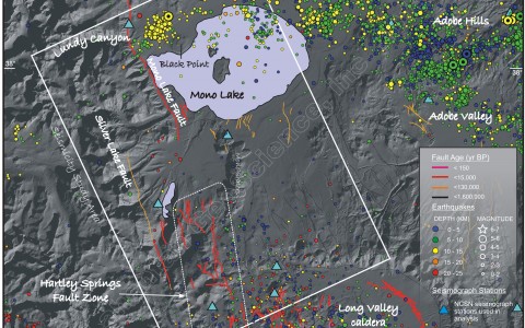
Seismotectonic Analysis of the Mono Basin Region, Eastern California
The seismotectonic setting for the Mono Basin region was analyzed by LGS to support the seismic hazard assessment of several dams in the region.
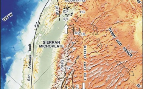
Kinematic Model of Deformation in the Eastern Sierra Nevada, California
The results of a seismotectonic analysis of earthquakes along the eastern margin of the Sierra Nevada has led to the development of a kinematic model of deformation that was used to assess the seismic hazard to several dams in northern California.
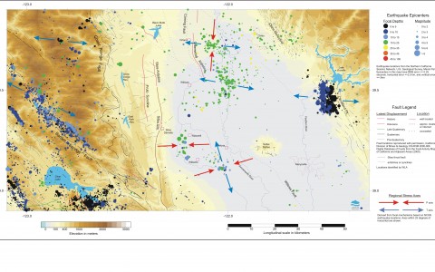
Seismotectonic Analysis of Northern California
A seismotectonic analysis of earthquakes in northern California was conducted by LGS to characterize the regional tectonics that drive local deformation.
Seismic Hazard Analysis in the West Sacramento Valley
LGS evaluated earthquake activity in northwestern California to identify potential seismic sources capable of generating significant ground motion at several damsites as part of a seismic hazard analysis for the California Department of Water Resources.
Earthquake Monitoring and Seismic Network Operation
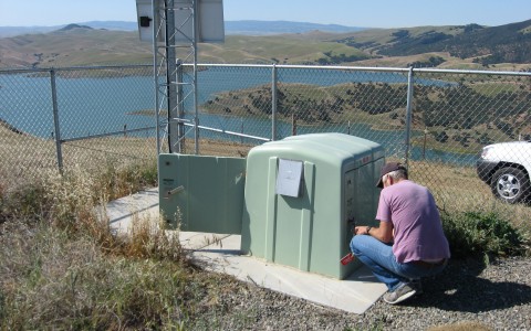
LGS has extensive experience in the design, procurement and operation of temporary earthquake monitoring networks to evaluate to potential for induced seismicity and characterize seismic sources for earthquake hazard analysis.
Seismic Hazard Assessment in Guinea
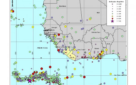
LGS performed a preliminary seismic hazard assessment in Guinea as part of a pre-feasibility study for a project to develop the country's vast iron ore resources in the Simandou Range.
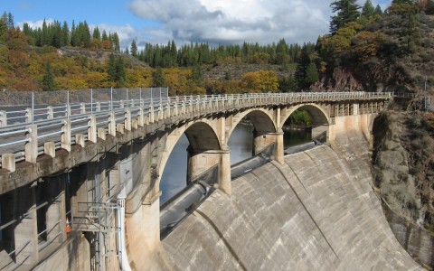
Reservoir Triggered Seismicity at Lake Oroville, California
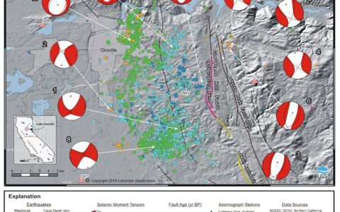
Evidence of reservoir triggered seismicity from seismic moment tensors south of Lake Oroville showing both DC and non-DC earthquake sources
